STARA PLANINA WATERFALLS part IV (Skok, Dvojni, Ivkov vir, Vodotok)
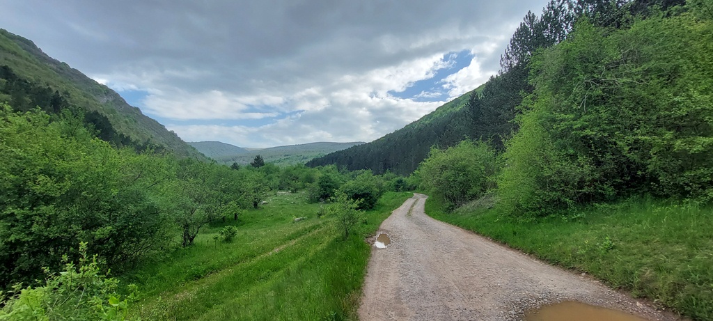
These waterfalls are located in the village of Senokos, which is also the starting point of this route. The distance between Belgrade and Senokos is 340 km (4-5 hours by car). The starting point is in the center of the village. The signposts are clear, as are the markings to the first waterfall, called Skok (Bounce). You will follow Vodenicka river all the time. The first 3 km is a macadam road, then it turns onto a forest path, at the point where a signpost to the waterfalls stands.
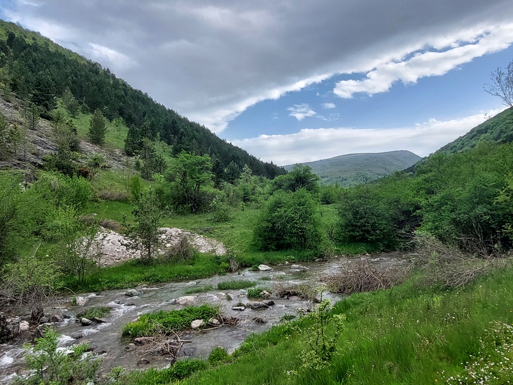
Vodenicka river
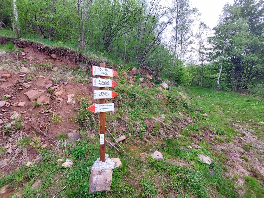
From this point, there is about 3 km to the last waterfall (Vodotok). All four waterfalls are located in the last 500 meters of the third kilometer. The first one is Skok (Bounce).
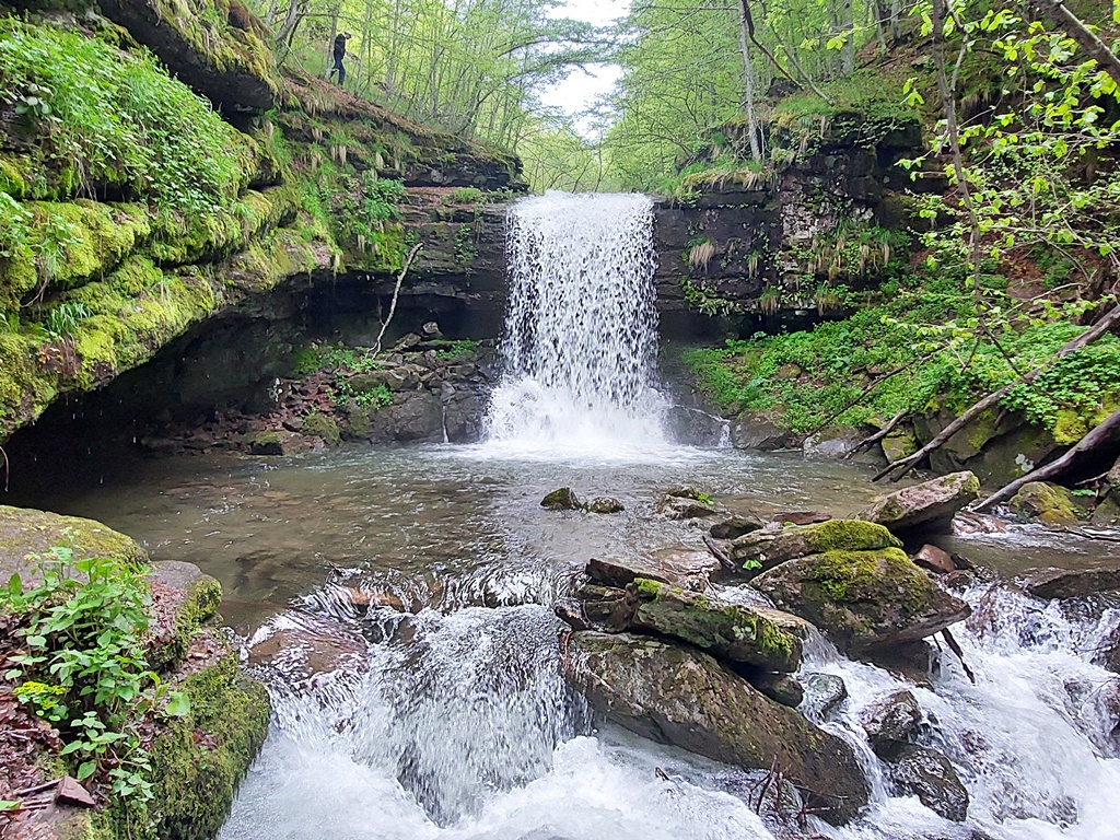
Waterfall Skok
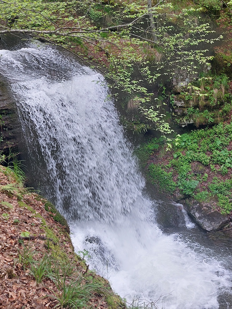
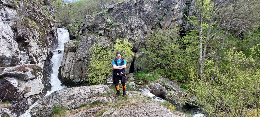
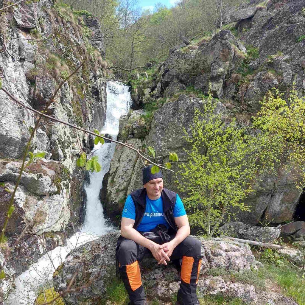
This waterfall is, perhaps, the most beautiful on the Vodenicka river. It is 10 m high and very interesting. It is one of the rare waterfalls at Stara planina that can be approached “from behind”, when the water level is low. Access to Skok is secured and safe.
Some 300 m after Skok, you will come to the next one, called Dvojni (Double waterfall). From Skok, the trail is not marked, but that is not a problem. Two white bags, which someone tied to a tree, represents the place where you must descend to this waterfall. The path is visible, but caution is required when it is slippery. Why it’s called Dvojni (Double), you’ll understand when you see it:
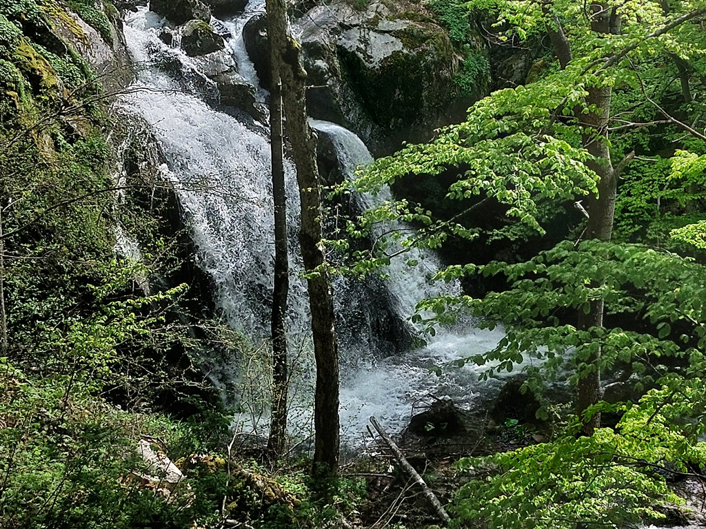
Waterfall Dvojni
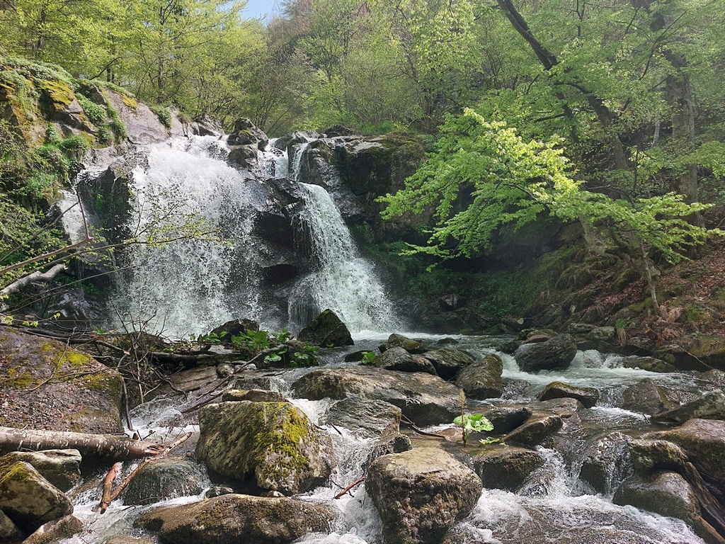
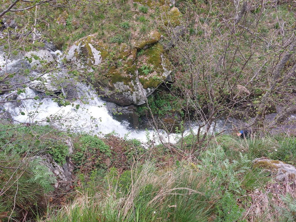
Very close to Dvojni waterfall (200-300 m) is the last accessible waterfall on this trail, Ivkov vir. Ivkov vir has two cascades. The lower cascade is much smaller and harder to see. But you can swim in the natural pool on the upper one. The turn for Ivkov Vir is also marked by one white bag.
Ivkov vir
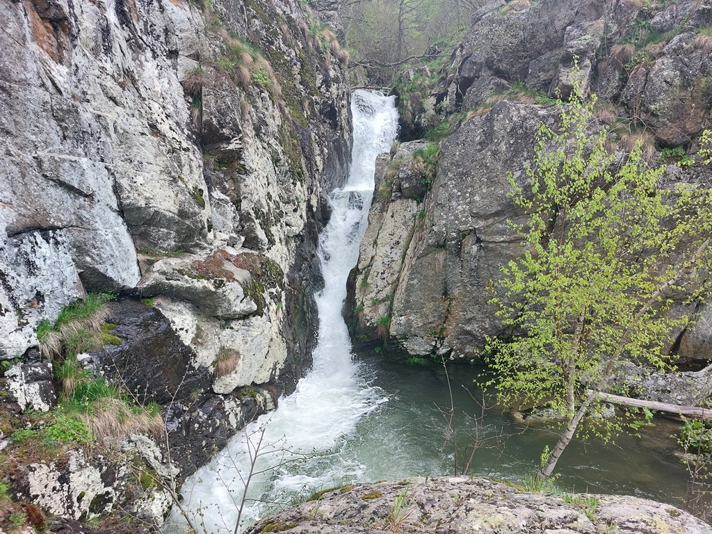
The next waterfall is called Vodotok, and it is located some 50 meters above Ivkov’s vir. There is no marking, in the form of bags, but you will know that there is a waterfall by the sound of the water. You can’t get up close and take a picture of it, so the next photo doesn’t show its full size.
Waterfall Vodotok
A little above Vodotok we spotted another small waterfall, but the access to it is not easy at all! At this point, the river becomes calm, and the path continues towards the most eastern point of Serbia, the peak of Srebrna glava (Silver head 1933 m).
This tour is very interesting, with an easy 12 km hike and 200 m of ascent. The first three waterfalls are of similar height, and they are all beautiful in their own way. I recommend everyone to explore Vodenicka river, especially in spring, when the waterfalls are in full strenght!
May 2023.
")
")

-
Recent Posts
Blogroll
 Srbija na dlanu
 SVETOGORSKE TURE
 Jooble