STARA PLANINA WATERFALLS part II (Bukovacki Do, Gornji and Donji Pilj, Grujin skok, Komin, Cungulj, Krmolj, Kurtul, Vurnja)
This tour is a sequel of the previous part (http://planine.net/stara-planina-waterfalls-part-i-tupavica-arbinje/) and it is based on the waterfalls located in the village of Topli Do. From the center of Pirot, drive in the direction of the village of Temska (there is a signpost). Distance between Pirot and Temska is 8 km. On the way from Temska, to the village of Topli Do, after 1.5 km, you will pass by the monastery of St. George, from the 16th century.
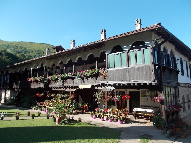

Monastery of St. George
Continue in the direction of Topli Do. After 1.5 km, you will see a board with the inscription “Bukovacki Do”, on the right side of the road. The waterfall is at 50 m from the asphalt road.
Waterfall Bukovacki Do
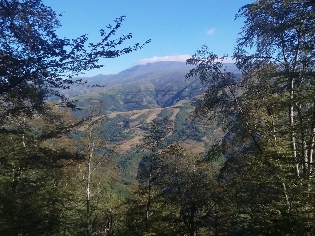
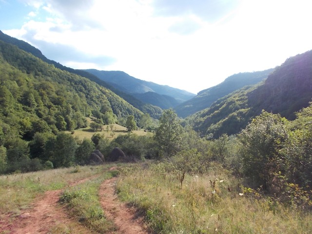
After 18 km you will arrive at Topli Do. Like in all villages of Stara Planina, time stands still in Topli Do.
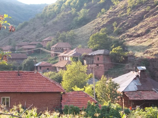
Topli Do
The village is small, so there will be no trouble to find the path to the waterfalls.
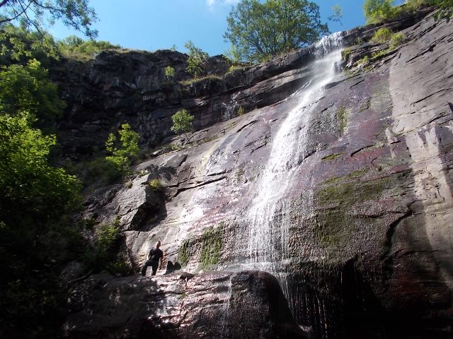
The trail is macadam and it is marked well. At the first crossroad, after a 20-minute walk, turn right for waterfall Gornji Pilj, or continue straight for waterfall Donji Pilj. A visit of all of the waterfalls, described here, is possible only if you start early, between 05:30 and 06:00, in the morning. So, the first turn is for waterfall Gornji Pilj. From this turn, to the waterfall, you must hike for 5.5 km (an hour and a half). Follow the main, macadam road. The trail is marked. Along the way, there is a view of peak Midzor and cliff Pilj, where the beautiful Pilj waterfalls are located.
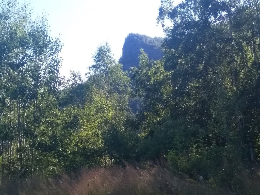
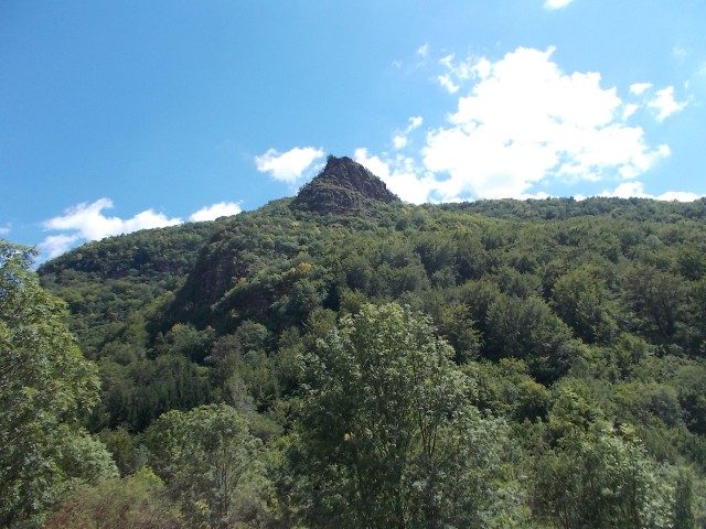
Cliff Pilj
Midzor peak
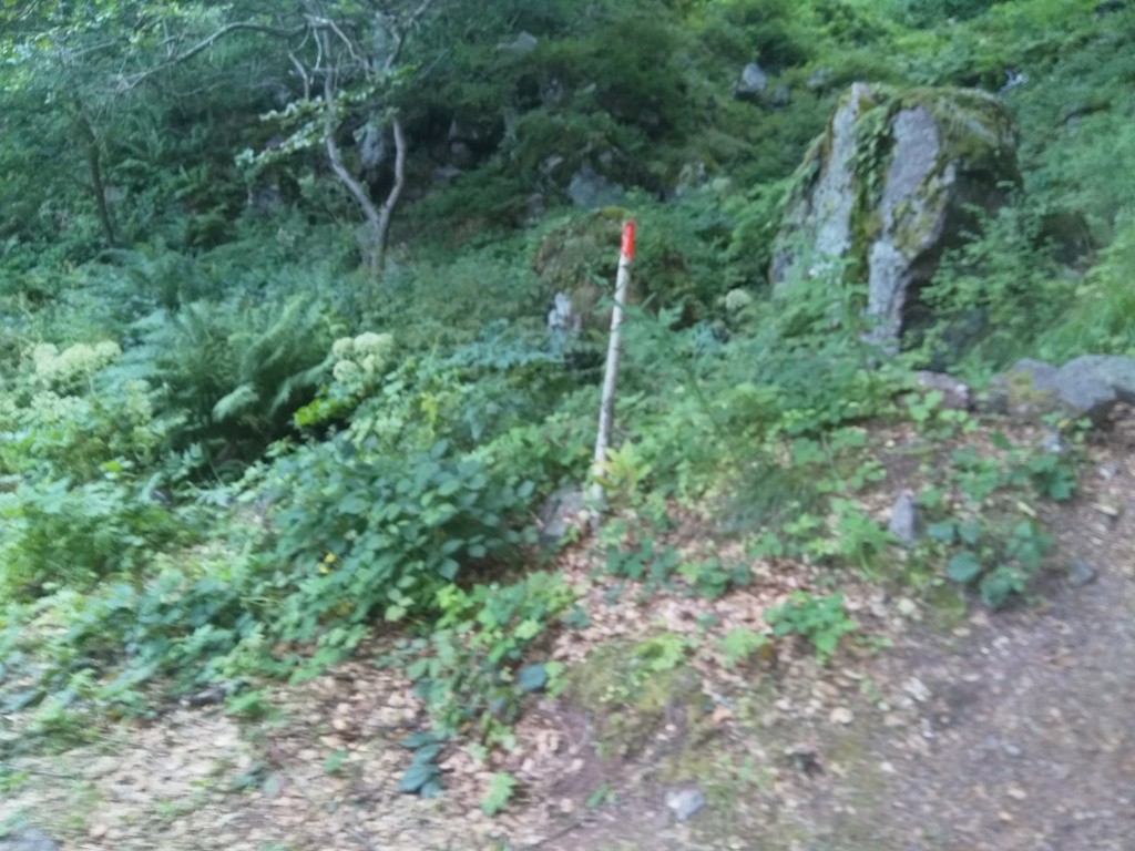
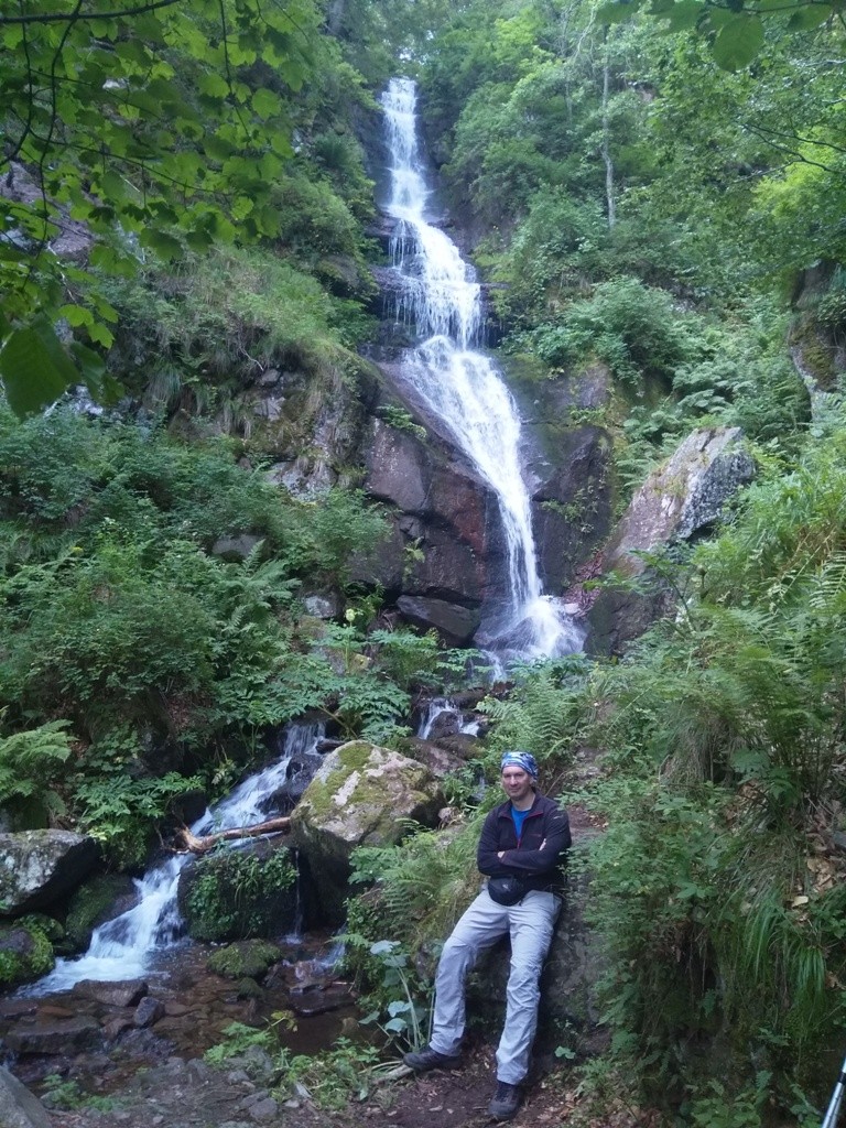
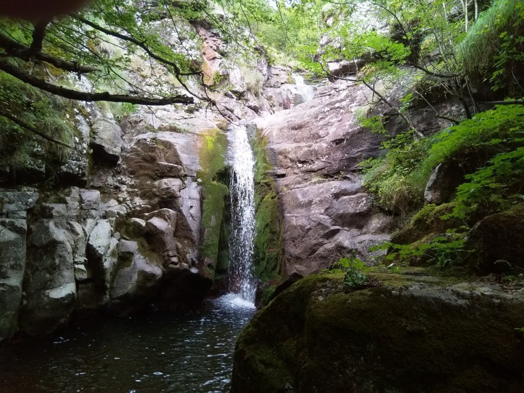
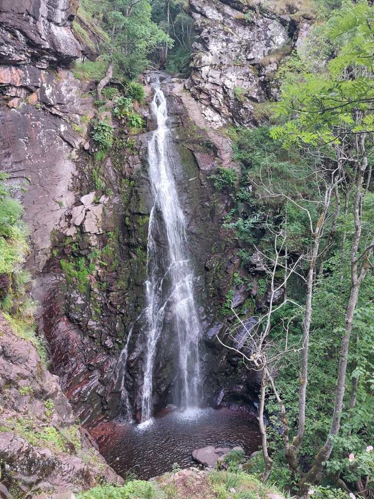
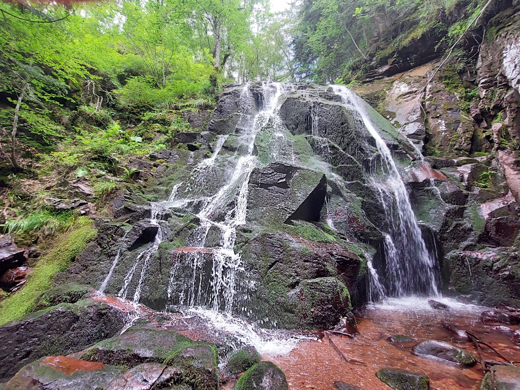
When you spot this wooden pole (painted red), you have arrived. Here you will see the first cascadess of waterfall Gornji Pilj. Go around the cliff, on your right, for next 100 m, and you will come to the magnificent waterfall Gornji Pilj (30 m high).
Waterfall Gornji Pilj
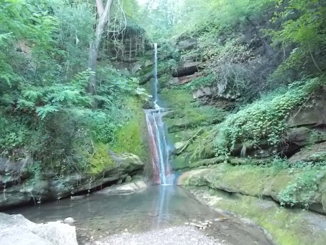
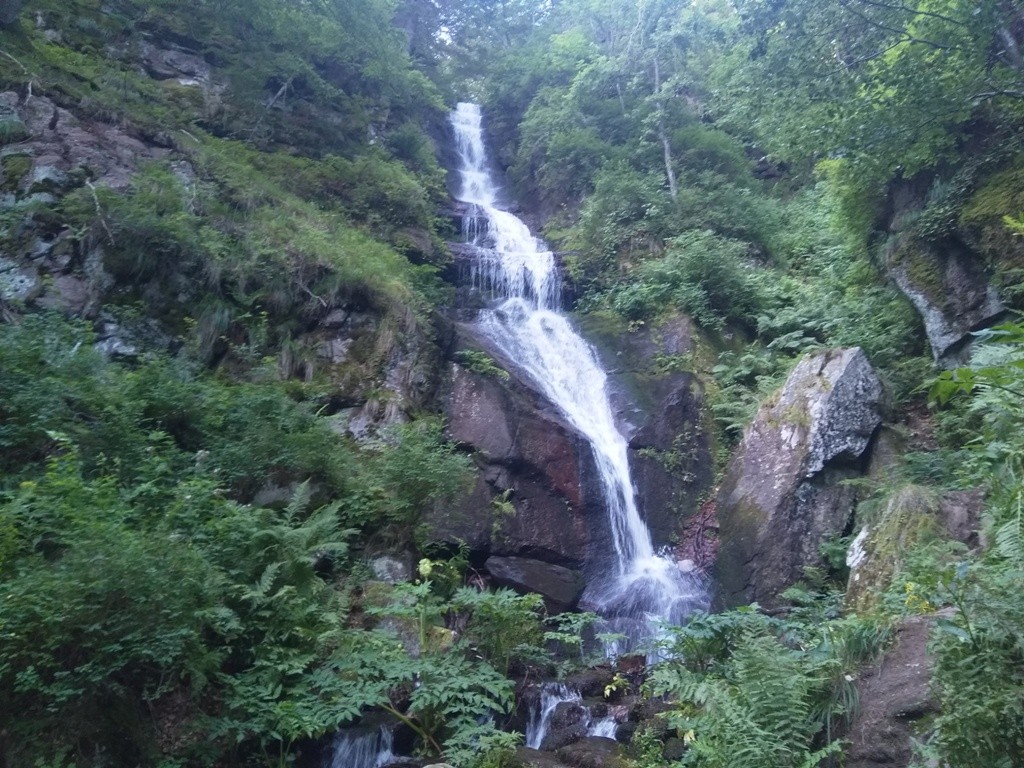
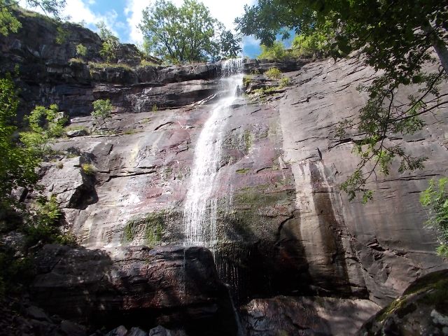
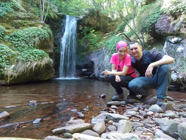
Waterfall Donji Pilj is 4,5 km far from the village. After 3 km from the village, you will come to an intersection. There is a signpost for waterfall Donji Pilj. At this intersection, turn right to the waterfall, into the forest. For the other waterfalls, the macadam path continues straight. Do not worry, everything is marked, the signs are clear, the path can not be missed. From village to the waterfall Pilj, you will walk for an hour and a half. The trail goes a bit uphill all the time. The waterfall itself is located at 1450 a.s.l. From the intersection, it takes half an hour of walk to the waterfall Pilj. You will be fascinated by this 64-meter high wonder of nature!
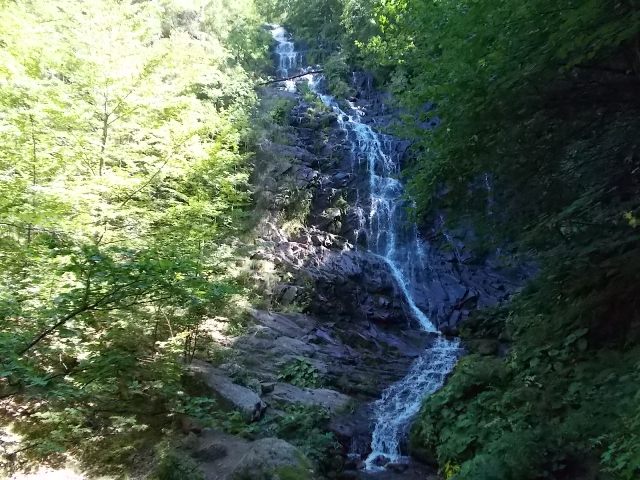
Waterfall Donji Pilj
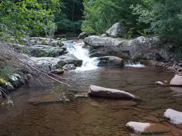
You will return to the intersection quickly, because you are descending down now. The road signs and markings will take you to the waterfalls Cungulj and Krmolj. Distance between intersecton for Donji Pilj and Cungulj waterfall, is about 4 km. Just follow Javorska river and enjoy the beauty.
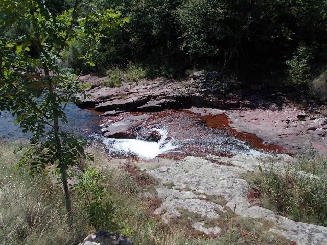
Javorska river
 About 1 km, from the intersection with waterfall Pilj, on the right side of the road, you will spot a table with sign “Grujin skok” and “Zeleni vir”. Turn in the direction of the signpost. First 300 m, you will walk by path. Then, you will cross the stream. Go upstream, for next 1200 m. You will easily spot the path, although it is not marked. You will come to a waterfall by the left side of the stream, so you have to cross it one more time. You will see where, that spot is quite clear. This is Grujin skok (15 m):
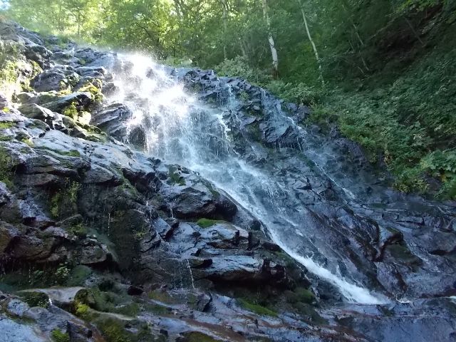
Waterfall Grujin skok
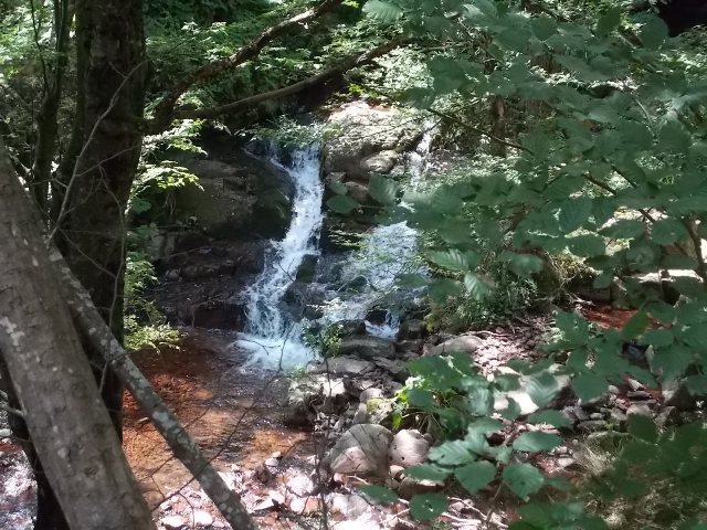
If you continue uphill and above Grujin skok, after 1 km (half an hour of walk) you will reach waterfall Komin (Green waterfall).
Komin
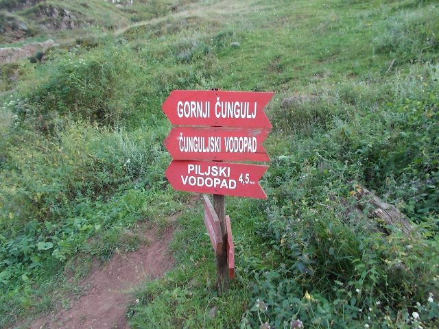
Go back, by the same path, onto the main road. At this photo, go left (signpost “Cunguljski and Kurtulski vodopad”).
Turn left
 Half an hour before the Cungulj waterfall, there is a turn for the Krmolj waterfalls. It’s better to visit them in return. Exactly 90 minutes, from the intersection with the waterfall Pilj, we came to the Cungulj waterfall. We also visited the Lower Cungulj waterfall. The path to the Cungulj waterfall leads through the forest (there are markings), but first you must pass a meadow with a high grass (read: nettles). Before you enter the forest toward the waterfall of Cungulj, there is a small path that leads to the left, at a plateau. Below the plateau is a Lower Cungulj waterfall.

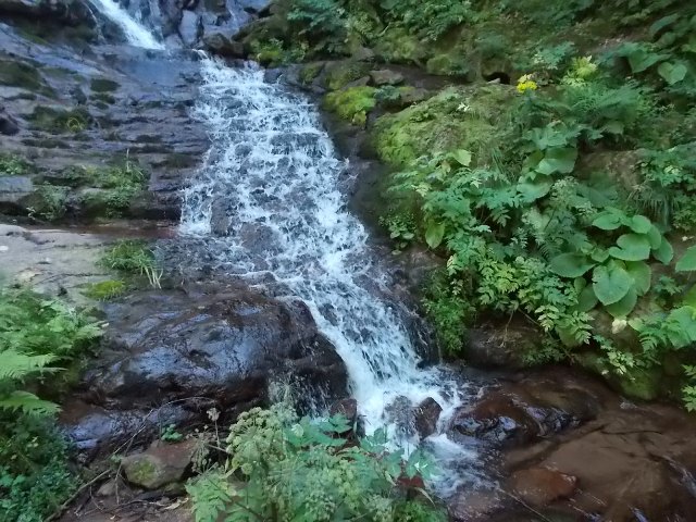
Lower Cungulj waterfall
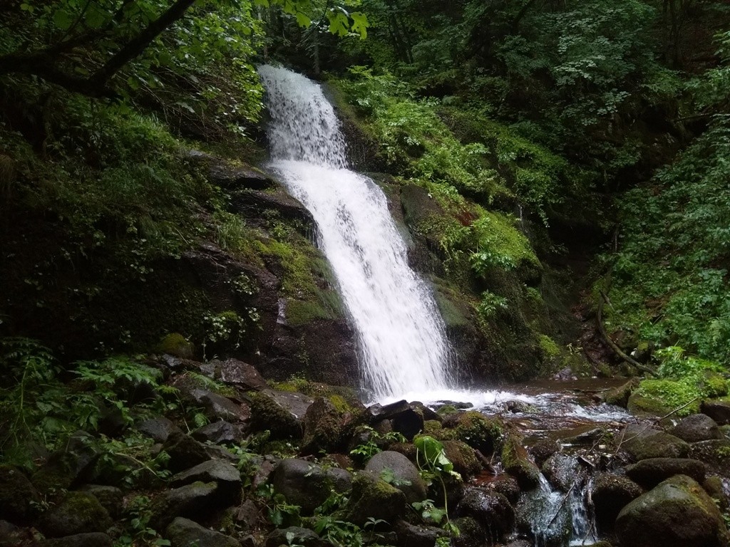
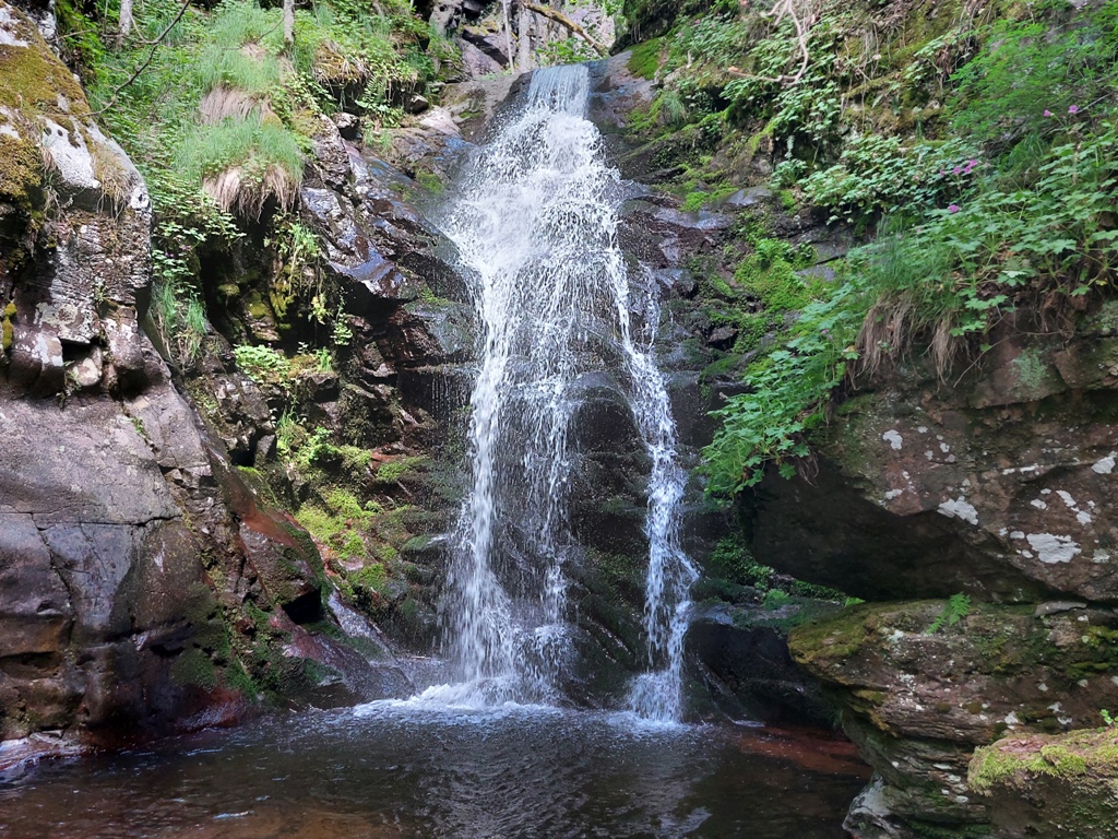
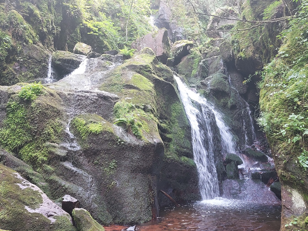
From the Lower Cungulj waterfall, it takes 15 minutes of walk to a much larger waterfall, Cungulj. The end of the path, at 1150 a.s.l, is a vertical rock, 45 meters high. This pearl of nature was unknown to the general public until 1996. Fascinating! This is the Cungulj waterfall:
Cungulj waterfall
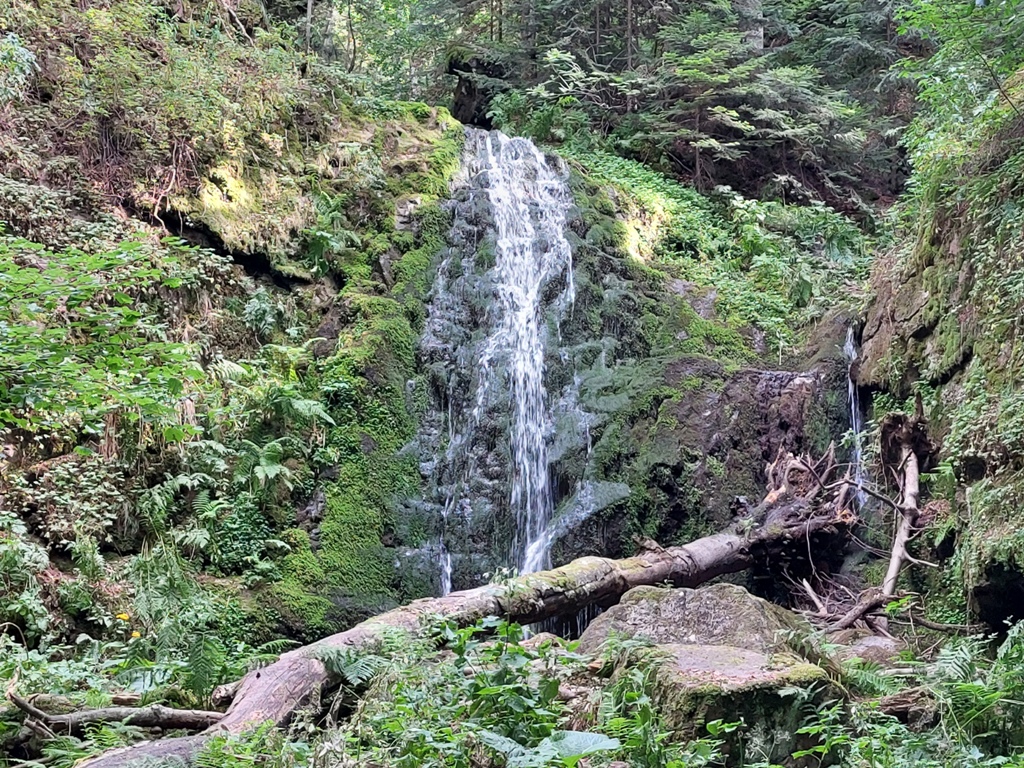
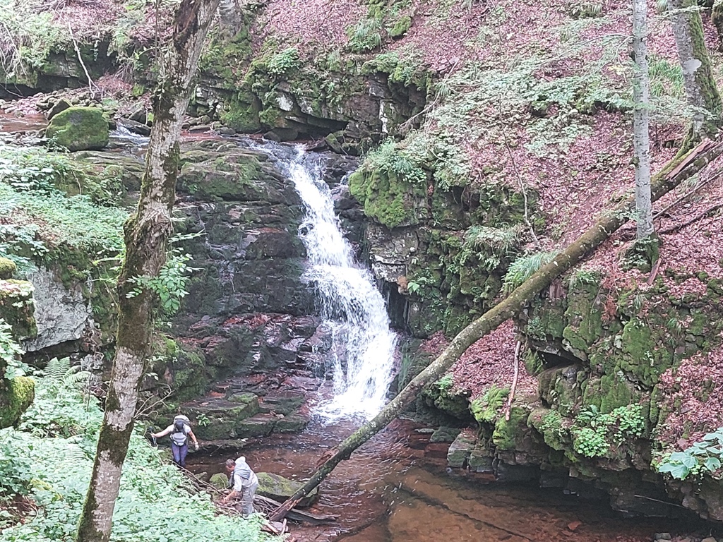
On our way back, we reached the intersection where “Krmolj” is written on the tree. The waterfall Donji (Lower) Krmolj is 3 minutes from here (there are markings). For me, this waterfall is like a fairy tale!
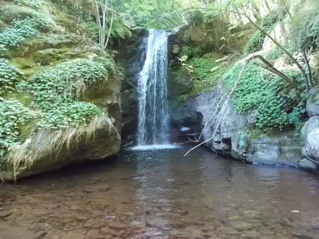
Waterfall Donji Krmolj
Waterfall Donji Krmolj is 10 m high. If you walk by the left side of Donji Krmolj, you will arrive at the top of this waterfall in a few seconds. Cross the stream and you will see a marking on a tree. Follow the marking and a small path to the left and, after 50 m, you will reach another waterfall, Gornji (Upper) Krmolj. Enjoy!
Waterfall Upper Krmolj
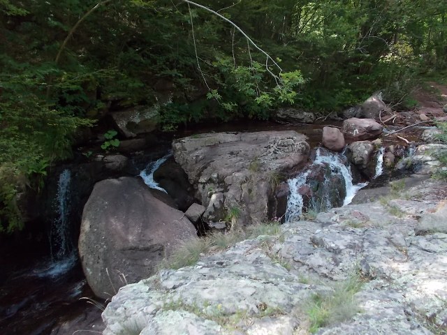
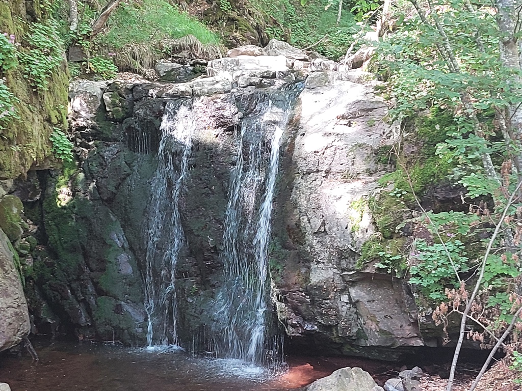
When you return, from Krmoljski waterfall, at the main road, continue in the direction of Cungulj waterfalls. After 250 m, where the path for waterfall Cungulj enters the forest, turn right, in the direction of the signpost “Kurtul”. The macadam road leads you to a stream, where an unnamed waterfall lies, and next to it is the last signpost for Kurtul:
Waterfall Donji (Lower) Kurtul is at ten minute walk from the unnmaned waterfall. Just follow the stream. From the crossroad for waterfall Cungulj, it takes about 20 minutes of walk to the waterfall Donji Kurtul.
Donji Kurtul
The upper cascade of the Kurtul waterfall is 27 m high and it is more beautiful and fascinating than the lower cascade. To reach the waterfall of Gornji (Upper) Kurtul, turn left before the Lower Kurtul, onto a barely noticeable path. The trail bypasses Lower Kurtul on the left and takes you to the Upper Kurtul in 5 minutes. Be careful above the upper cascade; the path is narrow and steep! But the view is magnificent!
Gornji Kurtul
When you turn right, from the intersection for Krmoljski, Kurtulski and Čungulj waterfalls, you will be on the path to the four waterfalls of Vurnja, on the Batska river. On this path, 3 km long, there are four beautiful waterfalls, 6-7 meters high. The last one is the most beautiful, but also the most inaccessible. The first three are easy to reach.
Vurnja 1
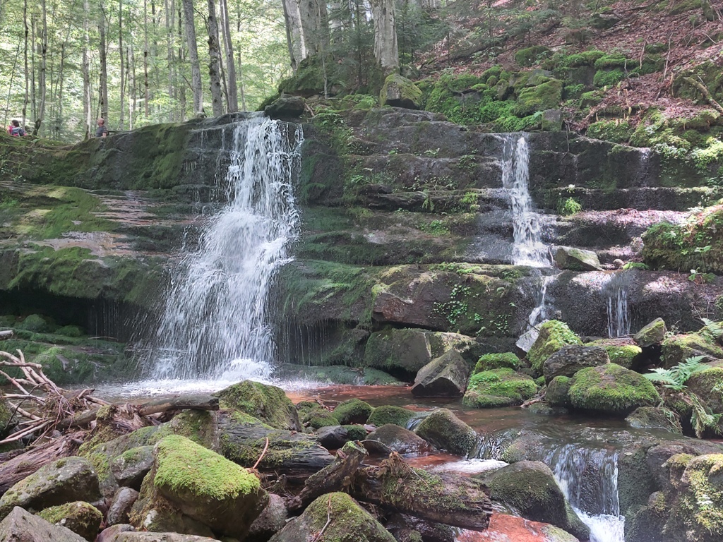
Vurnja 2
Vurnja 3
The last, the fourth waterfall in the row, is called Koritski (Ivicin) skok. The path to this waterfall leads to the left, before the third waterfall, where the rope is hung. The climb is not for unprepared mountaineers. If it’s slippery, give up! After climbing the rope, follow the path for another 200-300 m and you will come to the foothill of this fantastic waterfall!
Koritski (Ivicin) skok
Continue at http://planine.net/serbia/east-serbia/stara-planina-waterfalls-part-iii-bigar-kaludjerski-skok-vrla-strana/
August 2018.
")

")
-
Recent Posts
Blogroll
 Srbija na dlanu
 SVETOGORSKE TURE
 Jooble